If you watch many espionage or terrorism movies set in the present day, there’s usually a scene where some government employee enhances a satellite image to show a clear picture of the main villain’s face. Do modern spy satellites have that kind of resolution? We don’t know, and if we did we couldn’t tell you anyway. But we do know that even with unclassified resolution, scientists are using satellite imagery and machine learning to count things like elephant populations.
When you think about it, it is a hard problem to count wildlife populations in their habitat. First, if you go in person you disturb the target animals. Even a drone is probably going to upset timid wildlife. Then there is the problem with trying to cover a large area and figuring out if the elephant you see today is the same one as one you saw yesterday. If you guess wrong you will either undercount or overcount.
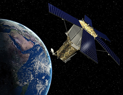
The Oxford scientists counting elephants used the Worldview-3 satellite. It collects up to 680,000 square kilometers every day. You aren’t disturbing any of the observed creatures, and since each shot covers a huge swath of territory, your problem of double counting all but vanishes.
Not Unique
Apparently, counting animals from space is nothing new. Brute force, you get a grad student to count from a picture. But automated methods work in certain circumstances. Everything from whales to penguins has been subject to counting from orbit, but typically using water or ice as a background.
There have even been efforts to deduce animal populations from secondary data. For example, penguin counts can be estimated by the stains they leave on the ice. Yeah, those stains.
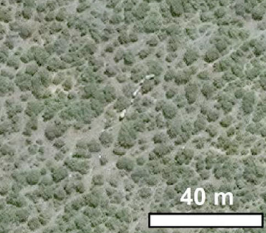
However, when counting the number of elephants at the Addo Elephant National Park in South Africa, there was no clear background. The grounds are forested and it frequently rains. The other challenge is that the elephants don’t always look the same. For example, they cover themselves in mud to cool down. Can a machine learn to recognize distinct elephants from high-resolution space photos?
How High?
The Worldview satellites have the highest resolution currently available to commercial users. The resolution is down to 31 cm. For Americans, that’s enough to pick out something about 1 foot long. That may not sound too impressive until you realize the satellite is about 383 miles above the Earth’s surface. That’s roughly like taking a picture from New York City and seeing things in Newport News, Virginia.
The researchers didn’t specifically task the satellite to look at the park. Instead, they pulled historical images from passes over the park. You can find out what data the satellite has, although you might not get the best or …read more
Source:: Hackaday